Page path:
- Home
- ...
- INTERCOAST
- Latest News
- Archiv
- News 2015
- 05-03-2015 Fieldwork successfully conducted - A...
- IC 3 - Fieldwork successfully conducted
INTERCOAST
IC 3 - Fieldwork successfully conducted
Anthropogenic impact on the marine sediments in the Hauraki Gulf, New Zealand
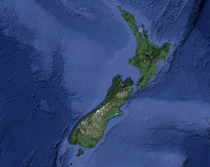
The main goal of this study is to decipher the human impact on the long-term development of the two key regions in the Intercoast project, the German Bight and the Hauraki Gulf. The Hauraki Gulf is a shallow, partially enclosed sea on the northeast coast of the North Island of New Zealand. It is bounded to the south and west by the mainland, and to the east by the Coromandel Peninsula and Great Barrier Island.

Study area on the northern North Island in New Zealand
The Hauraki Gulf with a catchment area of 4000 km2 has gone through significant environmental changes during the last centuries, beginning with the Polynesian migration to New Zealand in the 14th century. With the beginning of the European settlement in the Hauraki Gulf region in the early 19th century severe changes in the environment such as the removal of forests, the onset of industrialization and mining (e.g. gold mining on Coromandel Peninsula) could be observed. Today, Auckland, New Zealand`s biggest city with a population of over 1.4 million, is situated in the Hauraki Gulf region and plays a major role in the marine environmental pollution.
The fieldwork for the Intercoast project IC3-II was originally planned for early December, but due to bad weather conditions (December was very stormy) and lacking availability of appropriate boats we had to shift the plan to the new year. Finally, on the 28th of January the weather was fine and the research vessel Macy Gray from Western Work Boats was available so that we could start the fieldwork.
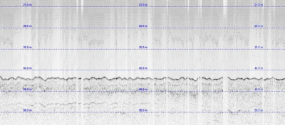
The plan was to take short sediments cores with the highest possible resolution and a high amount of clay particles. A first indication of sedimentation rates in the Hauraki Gulf was given by Manighetti et al. (1999). In order to get a more detailed insight in the surface sediments, a 50km long reflection seismic survey was conducted through one of the sediment depocenters in the Hauraki Gulf using a Knudsen Pinger Sub-bottom profiler. In the seismic profiles (see picture) you can see different sedimentary structures that allow you to make some statements about the thickness of sediment layers.
Based on the knowledge gained from the seismic profiles that the sediments in the southern part of the depocenter were finer grained, we decided to put the focus on the southern area. Heavy metals as major environmental pollutants are usually associated with clay minerals in sediments, therefore we aimed to find sediments with a high clay amount.
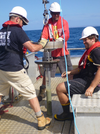
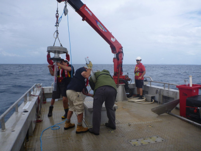
In total 14 sediment cores were taken with a Rumohr Corer. The whole corer was maneuvered by a crane aboard the Macy Gray. As soon as is hits the seafloor, the corer gently sinks in the sediment just by gravity (total weight > 80kg), and the mechanism that keeps the lid opened is disengaged. Upon pulling the core up, the lid seals the top opening, exerting a suction that prevents the sediment from sliding out of the pipe. When the corer lands on deck, the bottom of the 1m long pipe attached to the corer is sealed as well with a rubber plug.
The cores with lengths between 15 and 60 cm have been subsampled immediately after the sampling campaign. Within the next few weeks I will perform grain size analysis and XRF-measurements on the overall 475 samples.

Example of a seismic profile recorded during the fieldwork

Rumohr Corer with a “fresh” sediment core

The whole crew in action
All in all, I can say that the fieldwork was very successful, which was especially because of the fantastic team we had on board. We successfully performed all the work on only one (long) day. Thanks to the Western Work Boats crew, to Dirk Immenga, to my supervisor Dr. Willem de Lange and to Vicki Moon, who helped me a lot on that day.
Manighetti, B., & Carter, L. (1999). Across-shelf sediment dispersal, Hauraki Gulf, New Zealand. Marine Geology, 160, 271-300.
Manighetti, B., & Carter, L. (1999). Across-shelf sediment dispersal, Hauraki Gulf, New Zealand. Marine Geology, 160, 271-300.


