- Home
- Our Methods
- Modelling
- Geodynamics and Hydrothermal Models
Geodynamics and Hydrothermal Models

Geodynamics and Hydrothermal Models
From the millennial to the geologic scales of continental growth and the supercontinent cycle, the tectonics settings throughout the Earth system influence climate and the ecosystems it hosts. Beyond the control that global topography and bathymetry exert on global wind patterns and global ocean circulation, tectonics defines the regional stress regimes that strongly control the nature of heat sources from the Earth’s interior (magmatic vs. amagmatic), the variability of which is associated with major climate events. A striking example is the largest mass extinction on Earth caused by global warming at the end of the Permian period. The magmatic volcanic eruptions of that time (the time of the supercontinent Pangaea, 252 million years ago) created a global greenhouse planet, leading to an unbreathable ocean and the extinction of about 96 percent of marine species.
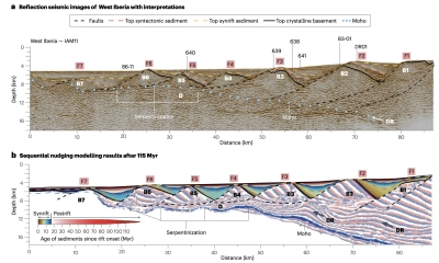
Our Earth System Modelling includes another class of numerical models focused on tectonic processes and associated hydrothermal systems. Our geodynamic models include isostasy, magma generation and emplacement in the lithosphere, erosion and sedimentation processes, metamorphic thermodynamics, and hydrothermal circulation. We focus on timescales from the breakup of Pangaea to the present. These processes are not only an important component of the Earth system in relation to climate and ocean biogeochemistry, but are also highly relevant in relation to hydrothermal energy and ore-forming processes, which are key to the energy transition.


